> One question: exactly where IS this lost graveyard? Inquiring minds want to know.
Very well, I will entrust you and you alone with this momentous secret.
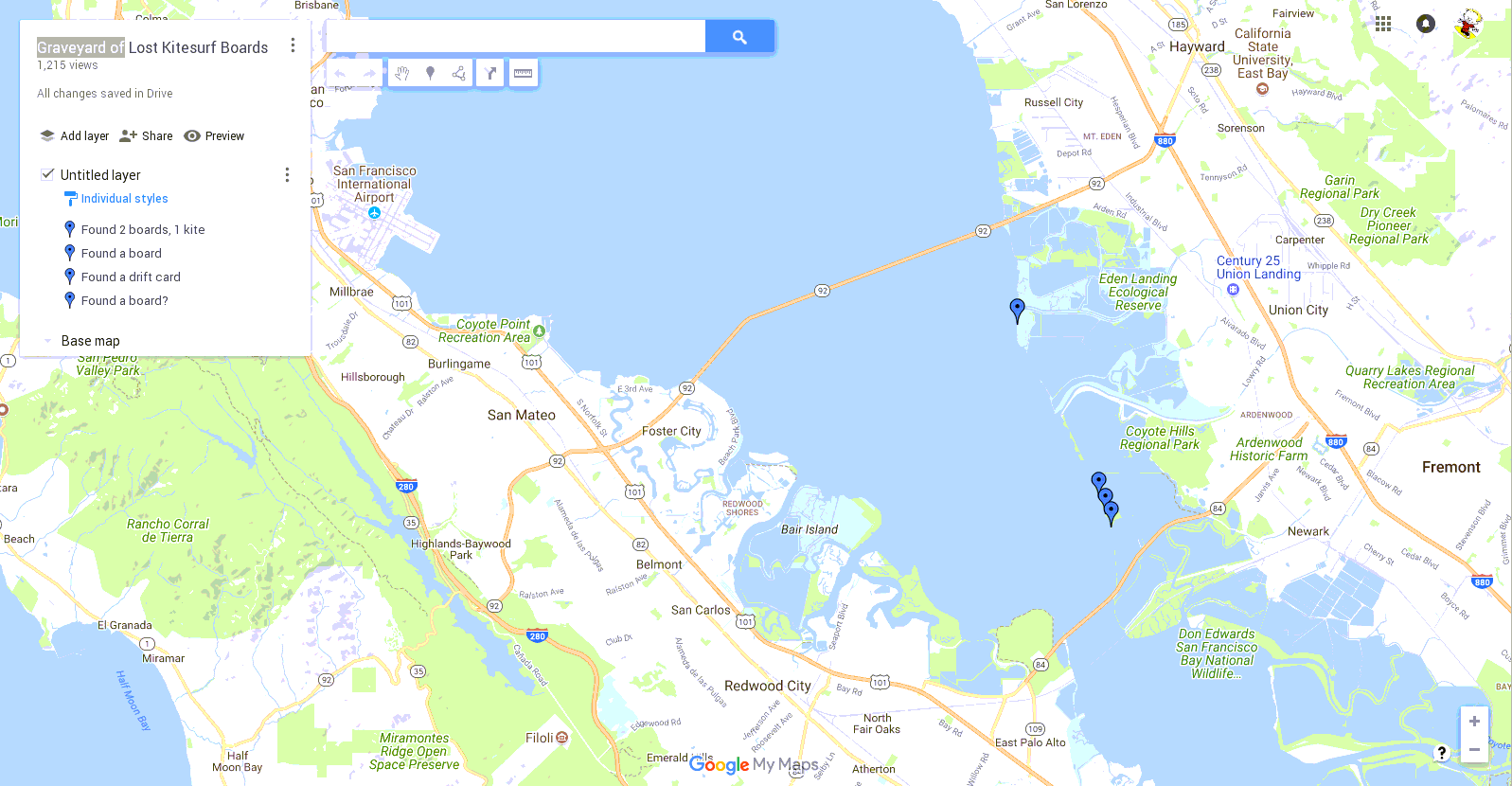
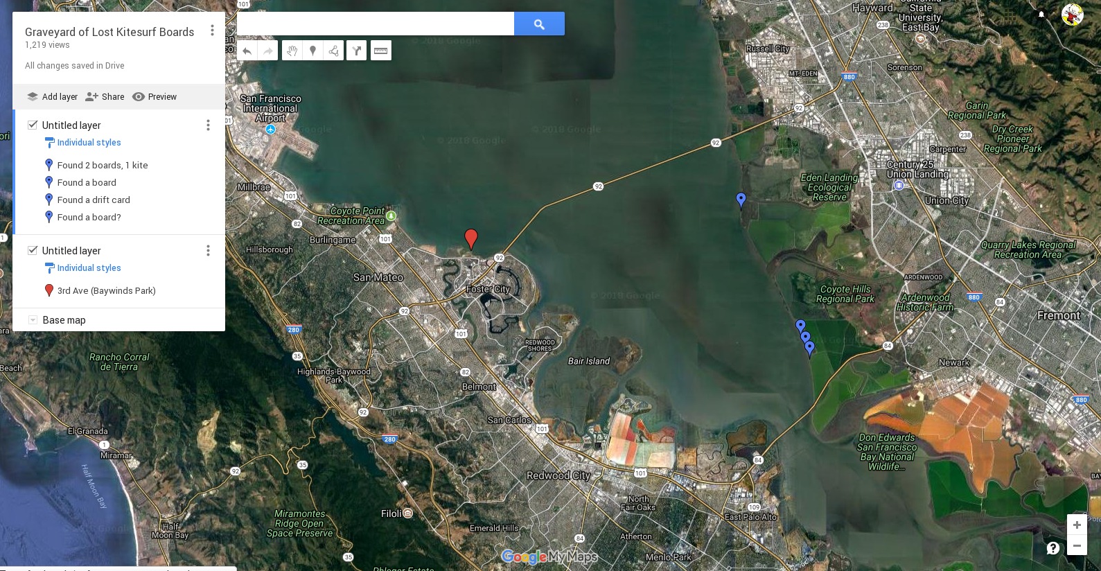
This treasure map is has been handed down through generations of kitesurfers, all sworn to utter secrecy with the mystical chant prayforwindprayforwind. The map is worn and faded and slow to refresh. Worst of all, there is no X to mark the spot, just some little blue bubbles. Oh yeah, even worster, the treasure at the blue bubbles has already been collected.
By applying a magical solution to the map (6% saline seems to work), the following cryptic instructions appear:
Why here? On a good NW wind day, the wind follows the SFO runways, passes under the middle of the SM bridge and hits the East Bay shoreline at the foot of the Dumbarten Bridge. On west days, the wind carries from 3rd to the shore halfway from the Dumbarten to the SM bridge. At night, the wind often turns SW, and boards might even end up N of the SM Bridge. Check ikitesurf.com for the wind direction in the days after your loss.
Twintips and directional boards will mostly follow the tidal current back and forth (in the channel, about 7 miles on each tide), with only a small wind drift speed, especially if they are strap-down in the water. But eventually the wind will usually carry them to the east shore. A board with a GoJoe will follow the wind much more rapidly. Foil boards will tend to move quite rapidly in the direction of the waves. This is mostly in the wind direction, but turns towards the shore as the water gets shallow. Foilboards have been found the next day. Other boards have sometimes taken a week to be found.
Note that the levees at the shoreline are generally walkable or bikeable, and visible from the water, but I have never found anything but a shredded kite in these areas. I think this is because these paths are visited by dozens of people in a week, some of them actively looking for things to sell. Equipment which has been floating against a levee tends to get scraped up. I recommend searching these areas several times by bicyle; you go into the Don Edwards Preserve and park at the E foot of the Dumbarten Bridge.
The productive shoreline is where the levee and road is set back from the shoreline and there are grass or pickleweed marshes at the shore. Some of this shoreline is reachable by bike and (muddy) foot, some is hard to reach that way. The pickleweed marshes seem to be at +8 or +9 feet elevation - these are very high tides. They are easy to walk on, except for the drainage channels which cross them, which are up to 4 feet deep, and 2-10 feet wide. Be sure someone knows where you are going.
The best approach for the marshy areas is to go by jetski. Go at a high tide (6-7 feet) so you can get close to the shore and in the morning so there is little wind. Take two people so one can drive the ski while the other walks the shore; you can't see well enough from a jetski to see most boards up on the weeds. Plan for mud; wetsuit and booties are recommended. Boards recovered along here are in very good condition.
Good hunting!
Ken
"I ought to say," explained Pooh, "that it isn't an ordinary sort of boat. It all depends."
"Depends on what?"
"On whether I'm on top of it, or whether I'm underneath."
-- Winnie-the-Pooh, A.A. Milne
webman at poulton dot net /users/poulton/public_html/windsurf/graveyard_of_lost_kiteboards.html